Thinking about buying a Smith Lake lot and adding a private dock later? Before you picture sunrise coffee on the water, make sure the shoreline and the rules will actually allow it. With the right due diligence, you can avoid surprises, control costs, and choose a lot that fits your boating plans and budget. This guide walks you through the regulations, site traits, and step-by-step checks that confirm real dock potential. Let’s dive in.
Know the rules first
Approvals come before construction on Smith Lake. Alabama Power manages the reservoir and typically controls dock licensing along most shorelines. You will also deal with local permitting, and in some cases federal or state reviews. Start with early outreach so you can confirm what is allowed on a specific lot.
Alabama Power basics
Alabama Power’s Shoreline and Waterways program usually issues approvals, licenses, or leases for private docks. You will need a site plan, dock drawings, and details like water depths at the proposed location. Their standards cover allowed dock types, dimensions, setbacks, and construction methods. Ask about fees, timelines, and whether approvals transfer when a property sells.
Federal and state permits
Depending on how the dock is designed and anchored, the U.S. Army Corps of Engineers may require permits for work in navigable waters or for any fill placed in waters or wetlands. State agencies like the Alabama Department of Environmental Management can require erosion control and water-quality safeguards during shoreline work. A quick verification from these agencies helps you confirm what applies.
Local and HOA rules
County building and health departments in Cullman, Winston, Lawrence, or Morgan County handle building, electrical, and septic permits. Floodplain administrators enforce FEMA rules. Subdivision covenants or HOA guidelines often set dock size, style, and placement. Check these early. Some neighborhoods only allow community docks.
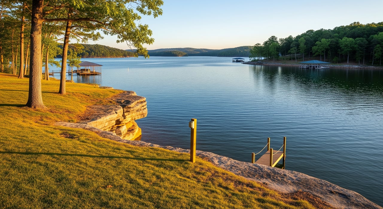
Read the shoreline
The physical site drives what you can build and how much it will cost. Walk the lot more than once and take notes on these factors.
Shoreline type and stability
- Rocky or riprap banks are typically stable and good for anchoring.
- Sand or gravel shores can work but may shift seasonally.
- Clay or silt can be soft and may need special foundations or floating systems.
- Marshy areas or wetland vegetation can trigger additional reviews and limit disturbance.
- Existing seawalls can help with access but can affect anchoring choices.
The substrate determines whether a floating dock, piling system, or a hybrid design makes sense.
Slope and topography
A gentle slope to the water usually means a shorter walkway and easier access. Steep banks often require stairs, long gangways, or engineered retaining. Ask a surveyor for a topographic map that shows the slope, vertical drop to the mean waterline, and any terraces. This will inform design and budget.
Water depth near shore
Match depth to your boats and plans. Pontoons and larger boats typically need 4 to 6 feet of depth at normal pool. Smaller runabouts can use 3 to 4 feet. Personal watercraft need less but still require safe approach and tie-off. Because Smith Lake’s levels change, ask for the normal pool elevation and typical seasonal drawdowns, then confirm depth at both normal and lower water.
Cove protection and exposure
Deep, narrow coves reduce wind and wake, which can lower maintenance and improve safety. Wide or open coves that face prevailing winds can be more exposed and may require sturdier designs or strategic placement. Watch neighbor docks for clues about exposure and design choices.
Neighbor docks and channels
You cannot block navigation. Know where channels and markers sit relative to your shoreline. Alabama Power typically sets minimum setbacks from channels and neighboring docks. Observe spacing patterns along your cove so you understand what is commonly approved.
Substrate and vegetation
Hard bottoms like rock or gravel support pilings better than silty beds. Thick aquatic vegetation often signals shallow areas or environmental constraints. If you expect to remove or manage vegetation, confirm what permits you need before you plan it.
Water-level fluctuations
Smith Lake serves hydroelectric and flood-control functions, so water levels move. Floating systems and adjustable gangways help you ride out drawdowns. Ask Alabama Power for typical fluctuation ranges and any charts for your area of the lake.
Legal and access checks
Riparian rights and access
Confirm that the lot is actually riparian and fronts the water, not just near it. If access is via an easement or community waterfront, private dock rights may not exist. Review the recorded deed and plat for reservations or shoreline restrictions.
Easements, setbacks, and covenants
Look for utility easements along the shore that might limit dock placement. Read subdivision covenants and HOA rules for dock style, size, and approval steps. Ask the county about shoreline and building setbacks that apply to your parcel.
Utilities at the shoreline
If you plan electrical power at the dock, confirm service routes, inspections, and wet-location standards such as GFCI and appropriate breakers. If you want water lines or a boathouse with utilities, coordinate with the county health department about septic and placement rules. Map out trenching and conduit early.
Construction access
Consider how builders will get materials to the water. If equipment cannot reach the shore, you may need barge access, which affects cost and schedule. A site plan that shows routes, staging, and shoreline protection can save time.
Insurance and ongoing obligations
Docks can raise liability exposure. Ask your insurer about coverage requirements for construction materials, electrical safety, and maintenance. Clarify whether Alabama Power’s authorization is a license or lease, any annual fees, and whether approvals are revocable or transferable.
Step-by-step due diligence
Follow this sequence to reduce risk and keep decisions clear.
- Preliminary records review
- Pull the deed, plat, HOA rules, and any prior permits.
- Confirm which county has jurisdiction for permitting and health.
- Early outreach
- Call Alabama Power’s Shoreline/Waterways team about dock eligibility and standards on that shoreline segment.
- Check with the county building office and health department on setbacks, floodplain, septic, and utility rules.
- Site reconnaissance
- Walk the shoreline at different water levels, if possible.
- Note neighbor docks, channel locations, wind exposure, and boat traffic.
- Take photos and GPS points from land and water.
- Professional surveys and reports
- Order a boundary and topographic survey with the existing shoreline and mean waterline noted if available.
- Get bathymetry or at least depth soundings where the dock would sit and along the approach.
- If the bank looks unstable, request a geotechnical check.
- If wetlands are suspected, ask for a delineation or environmental review.
- Concept and contractor input
- Share your surveys with 1 to 3 local marine contractors for design recommendations and budget ranges.
- Compare floating, piling, or hybrid options and maintenance needs.
- Permitting and approvals
- Submit plans to Alabama Power and local offices; verify if USACE review applies.
- Obtain written approvals and ask about transferability and conditions.
- Purchase contingencies
- Include contingencies for dock approval, septic/well, utility availability, and survey confirmation.
Simple buyer checklist
- Deed and plats reviewed for riparian rights and shoreline reservations
- HOA or covenants reviewed for dock limits and approvals
- Alabama Power contacted; guidance on dock allowance documented
- County building and health offices contacted; setbacks, septic, floodplain confirmed
- Topographic survey completed
- Bathymetric or depth survey completed at the planned dock site
- Geotechnical check if shoreline appears unstable
- Wetland review if vegetation or soils indicate wetlands
- Bids and feasibility from local dock contractors
- USACE verification or permit obtained if required
- Written approvals and fee schedule documented
- Construction access plan and utilities plan mapped
- Insurance implications reviewed with your carrier
Smart questions to ask
Alabama Power
- Is a private dock allowed on this shoreline segment, and which dock types and sizes meet your standards? What setbacks, drawings, depth data, and fees are required, and is authorization transferable?
County and health departments
- What shoreline and building setbacks apply to this parcel? Is any part in a mapped floodplain, and what septic or percolation standards govern structure placement and utilities?
Contractors and surveyors
- Based on topography and depth, which dock type and length fit my boat plans, what construction challenges do you expect, how long will permitting take, and do you handle submissions to agencies?
Budget and timeline
Approval timelines can range from a few weeks to several months, depending on reviews and season. Costs vary widely by design, shoreline conditions, and access. Simple floating docks are typically faster and less expensive to install. Pile-driven docks, boathouses, or shoreline stabilization add cost and complexity and often extend the schedule.
Practical site tips
- Visit during typical drawdown periods so you see low-water conditions and dock usability.
- Use a marked pole or handheld sounder to check depths across the planned footprint.
- Study neighbor docks for design clues and enforcement patterns.
- Compare weekday and weekend boat traffic to judge wake exposure and noise.
Final thoughts
A great Smith Lake dock starts with the right lot. If you confirm permissions, depth, slope, and access up front, you will build with confidence and avoid costly changes later. When you are ready to shortlist lots, we can help you align shoreline traits with your boating plans, connect you with surveyors and marine contractors, and keep your due diligence on track.
Ready to find the right waterfront lot and plan your future dock? Connect with the local team that lives on the lake at iHeart Smith Lake.
FAQs
What permits are needed for a dock on Smith Lake?
- You typically need Alabama Power’s dock authorization, plus local building and electrical permits, and sometimes USACE and state environmental reviews depending on design and location.
How deep should the water be at my dock on Smith Lake?
- Aim for about 4 to 6 feet at normal pool for larger boats, 3 to 4 feet for small runabouts, and confirm depths during typical seasonal drawdowns.
Can every Smith Lake waterfront lot get a private dock?
- Not always, because approvals depend on Alabama Power policies, setbacks, navigation clearance, water depth, shoreline conditions, and any HOA or deed restrictions.
How do Smith Lake water-level changes impact dock design?
- Fluctuations favor floating systems and adjustable gangways, and you should plan depth and placement that remain usable during drawdowns.
What dock type works best on steep or rocky banks?
- Designs often favor floating docks with longer gangways or engineered access, while rock can aid anchoring but may require specialized installation.
How long does dock approval take on Smith Lake?
- It varies by season and review needs, but expect a timeline from several weeks to a few months, especially if more agencies are involved.